Sci-fi Primers: Remote Sensing - Part 4
Avoid pitfalls and perform convincing handwaving in remote sensing

Handwaving Your Sensors to Life
In part 3, we covered some common misconceptions around remote sensing (e.g., “ship sensors”) in science fiction. Now, we’re going to we’ll discuss some ways to avoid pitfalls and perform convincing handwaving.

Time Constraints
Some good rules of thumb for time-delays introduced by a light-signal travelling one-way (which should give a flavour for how NOT to scale the above image is):
1 second between the Earth and the Moon
8 minutes between Earth and the Sun
5-20 minutes between the Earth and Mars (depending on orbital alignment between the planets)
35-52 minutes between the Earth and Jupiter (depending on orbital alignment between the planets)
4 hours between Earth and the Kuiper Belt (the effective edge of the solar system, where Pluto and other planetoids live)
22 hours between Earth and Voyager 1 (the most distant spacecraft launched to date, which crossed the heliopause in 2018)
Note that the furthest distance here is approximately equal to the radius of a solar system (the distance from the middle to the edge). So, for example, if two spaceships sit on opposite sides of the outer edge of a solar system, to have a conversation they’re going to have to send one 44 hour signal from ship A to ship B, and then another 44 hour signal from ship B to ship A. So, saying ‘hey, what’s up?’ and ‘not much, you?’ would take a minimum of 88 hours, or nearly 4 days.
Optical and Size Constraints
In part 3 we discussed the limits imposed by the laws of optics on the maximum resolution achievable with a given piece of equipment (i.e., no machine allows you to infinitely zoom in on something and maintain a clear picture). Particularly relevant is the diffraction limit. For details, see part 6. But we don’t have to resort to equations to get the rough idea.
A good rule of thumb is that a satellite carrying an instrument with a lens of the order 1 metre in diameter (which is huge) can resolve around 10cm per pixel on the Earth’s surface. So, in the absolute best case scenario, a human head would be represented by a single pixel.
This assumes no distortion of the image whatsoever due to imperfection in the lens, polluting light sources, or effects of the atmosphere—all of which are unavoidable in reality.
We can draw many talking points from this, but perhaps the two extremes are most useful:
A starfighter or small craft, carrying correspondingly small instruments, trying to see something far away (ship to ship or from orbit to a planet’s surface) will, at best, be able to see things the size of buildings or large ships. Interestingly, this means that starfighter-sized craft wouldn’t be able to see other starfighters beyond a certain range, because of diffraction constraints and also because so little energy could be gathered. They may have to rely on the sensing capabilities of a capital ship to see what other small craft are up to.
A truly enormous space probe or starship, complemented with very large sensory apparatus, would indeed be able to get clear pictures of things far away—perhaps even reading a license plate. But the apertures for each imaging device would have to be many metres across. This would make each telescope much bigger than a house, which gives reference for how big that ship needs to be.
Data Rate Constraints
The most common solution to a busted transmitter in sci-fi is “boost the power”. The idea being that if you pump more energy into the transmission, it’ll be a stronger signal.
There’s nothing wrong with that premise, but it’s not the whole picture, either. For example, pumping vast amounts of electricity into a transmitter that’s transmitting on the wrong frequency isn’t going to do anyone any good.
Another factor is the available bandwidth: the range of frequencies available to transmit over. If you want to transmit over a band of frequencies that overlaps with somebody else’s transmissions, the signals are going to be garbled. In practical terms, in a real solar system populated by technologically advanced species that use radio transmissions, this is going to be difficult to get around.
A good solution is to “boost the power” without having to inject huge amounts of power into the transmitter. This can be achieved by directing the transmission in a beam, instead of transmitting it in all directions like with most conventional transmitters. Directional antennas exist on many contemporary spacecraft, but even better is laser transmission: a very narrow-beamed transmission (which also cannot be intercepted by anyone not directly in the path of the beam).
In reality, at the time of writing, the best data-rate achieved between planets is probably the Mars Reconnaissance Orbiter (MRO), which manages to send data at a range of around 0.5-4 megabits/second back to Earth from orbit around Mars. For reference, the speed of 4G or an average domestic fibre-optic internet connection is around 100 megabits/second. So, as of 2024, the best data-rate achievable between neighbouring planets is only around 10 times faster than an old 56 kbit/second dialup connection from the 90s.
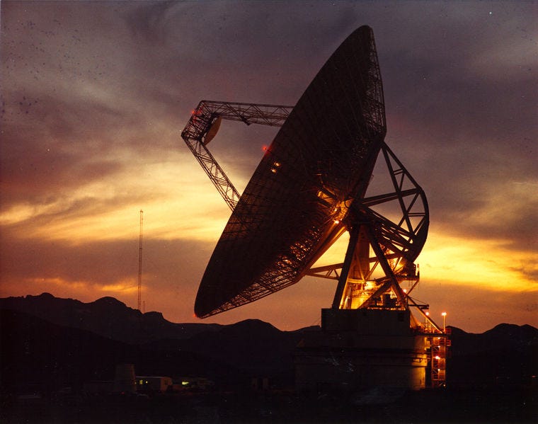
Even this is only possible because of the worldwide network of enormous radio antennas called the Deep Space Network operated by NASA.
Real Long-Range Scanners
The contemporary technology most similar to long-range scanners as presented in sci-fi is probably LiDAR (light detection and ranging). Instead of gathering ambient light or radio or other EM radiation, LiDAR pulses laser beams at a target and gathers what gets reflected, using the delay time to build up a picture in physical space. Similar to how bats use SONAR to perform echolocation, or a submarine uses RADAR (which relies on radio waves).
LiDAR is used to map terrain in surveys and by driverless cars to navigate. It can also be used from orbit, at least in clear weather conditions. The imaged area is small, and so building up a map of a large area would take a long time, but it is possible. In tandem with RADAR, which can penetrate clouds and provide wider coverage of topography, a planet’s surface could be mapped over time.
That concludes part 4. In part 5, we’ll wrap up with some recommended reading and other links.